SURE, WE'RE A SHUTTLE COMPANY.
But, we’re riders first.
A LITTLE ADVICE:
The desert, while beautiful, can be extremely harsh.
Please make sure to have plenty, I mean plenty of water, sunscreen, lip stuff, food and a map. Even though the routes can be well marked, maps are great for telling you where not to go. Also, if you need to abort your trip, it is good to know where you are and how to get off the trail. We also recommend wearing lightweight long sleeved shirts to prevent you from being sun-spanked!
MOAB HAS TRAILS, LOTS OF THEM!
Here are some of our favorite trails.
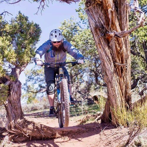
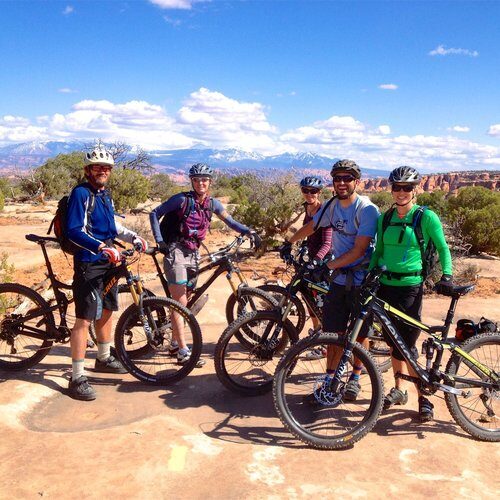
TRAIL DESCRIPTIONS
The super fun extendo version of Porcupine, aka THE WHOLE ENCHILADA: This 28 mile, incredible ride is a combination of multiple trails. TWE starts at 10,600 feet, tops out at 11,200 feet and ends at 3,900 feet. You do the math, lots of downhill fun! The trails include, Burro Pass, Hazard County, the Kokopelli, UPS, LPS and last but not least, Porcupine Rim (advanced). There is also some extra credit singletrack to replace the Kokopelli if you prefer, the Jimmy Keen singletrack. This trail starts at the Kokopelli Trailhead parking area and winds it’s way around Jimmy Keen Flat and leads directly to the start of the UPS trail. While this trail is relatively easy, it will add about an hour on to your ride. Coyote Shuttle will take you to all the trailheads to the famous "Whole Enchilada" ride!
SHUTTLE SCHEDULE >
MAGNIFICENT 7 (Crips Hole, Arth’s Corner, Great Escape, Little Canyon, Getaway, Gold Bar Singletrack, Gold Bar Rim to Portal (advanced) or alternatively, skip Gold Bar to Portal and head to the Moab Brand trails area (intermediate). This trail also includes portions of the Gemini Bridges Road. )
The Mag 7 starts off Highway 313 at the Gemini Bridges road and connects a series of trails to end with the classic Portal trail. This 18 mile-ish ride is a doozy. It requires fitness, technical ability and advanced route finding skills. The trail is marked but you definitely need a map for this area. You need to be prepared to head out across the rim. Alternatively, you can make it less epic by exiting out the Gemini Bridges Road to Highway 191. If you do this, you can either leave you car at the terminus of this trail (14-ish mile ride), ride back to town on the bike path (another 10 more miles to the north end of town) or, my favorite option, continue under the highway to the Moab Brand Trails area. Here you hop on the EZ trail, then jog onto Deadman’s, or Bar M to Bar B to Killer B, or EZ to Sidewinder then plop onto the bike path and cruise the rest of the way to town on the downhill (mostly) paved bike path (25-ish mile ride). Super fun! There are several other options to choose from at the Brand Trails area so be sure to grab a map. Also, please talk to us before leaving a car at the end of the trail as most of the time it can be incorporated into the shuttle (advanced with two intermediate options determined by exit).
More Rides:
MOAB BRAND TRAILS (Bar M, Circle O, Rockin’ A, Bar B, Deadman’s, Lazy, EZ, Rusty Spur(new), North 40(new) and Killer B: Because of their variety, these are great trails for the family, for a warm up ride, for your second ride of the day, in conjunction with the Mag 7 or with the addition of the new trails, an all dayer (it’s a word now!). The terrain stays interesting as it covers slickrock, doubletrack and also a bunch of fun singletrack. You can loop away up here! This is a great trail to shuttle for a family with different levels of riders as people can bail and ride the smooth downhill bike path back to town or for those of you who don’t want to drive while on vacation! (beginner-intermediate-advanced).
PIPE DREAM: Yeah! A singletrack you can ride right from town. This newer townie trail is a great addition to our growing series of singletrack. This trail is right under the Moab Rim and starts either south of town at the trailhead for Hidden Valley or on Aspen Street close to the Chile Pepper Bike shop off Kane Creek Road. This is an out and back ride, or you can make it a little easier by looping it with the Pipeline doubletrack or just on the highway. Even though this trail is just shy of 5 miles in length it is not for the faint hearted. It is tight, balancey (in the mountain biking lexicon), rocky, tricky, uppy and downy. The cumulative elevation gain is around 1000 feet even though you start at about 4150 and end at 4600. There is no day dream in Pipe Dream. (strong intermediate-advanced)
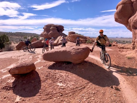 NAVAJO ROCKS: A great new ride that with beautiful views. This trail comprises of two loops that clam shell Highway 313. The main parking is in the middle of the two loops and the trail can be ridden in a figure 8 fashion. The surface of this trail is a mix of dirt and slick rock on the Navajo Sandstone formation. (solid intermediate)
AMASA BACK: You can’t beat the views on this ride and the trail is super fun too! This is a 15 mile out and back or you can add on Pothole Arch, Rockstacker and the Jackson Singletrack for an extra challenge. There is also the new Captain Ahab’s/HyMasa trails. Ride HyMasa up and then bomb down the downhill only Capt. Ahab’s. This trails will make you feel like you are a downhill Superstar! It is an advanced trail and the workmanship and consistency of all the rock ramps is amazing. They all roll and the singletrack is some of the most spectacular in the area. There are several intersections and choices out there so it is best to grab a map from the bike shop. (advanced)
SOVEREIGN: A series of fun singletrack loops north of town. This is a great area to practice your bike handling skills on desert singletrack. The main trail is about 14 miles out and back but there is plenty more riding and you can loop it up. The more you ride the more advanced it becomes. Definitely need a map! (solid intermediate)
DEAD HORSE POINT TRAILS: The Intrepid and Shafer trails at this state park offer about 18 miles of single track. This area has some great introductory desert single track and is good for families. While the singletrack is considered on the easier side of the Moab scale, it is great for all level of riders as you can get a great workout and the trail is interesting and keeps your brain engages. Dead Horse offers some of the best views of Behind the Rocks, the La Sal Mountains and Canyonlands National Park and is a great place to watch the sunset! (beginner-easier intermediate)
KLONDIKE BLUFFS(North and South): The original Klondike Bluffs road can still be ridden to a point where you can take a short hike out for a view of Arches National Park but with all the added new singletrack in the area, why ride a road? From the Klondike North Trailhead, you can access singletrack for all levels. The singletrack includes Baby Steps, Mega Steps, Little Salty, EKG, Dino Flow and more. A new favorite of mine is the Alaska Trail. There is also Agate, Jasper and Jurassic, all great for people who are newer to the sport, with Jurassic being the most beginner friendly. Once again, I highly recommend a map even though the trails are well marked. ( beginner-intermediate-advanced)
KLONZO: A newer area out by the Sovereign Trail System. The singletrack here is great for the newer rider looking to hone their skills. Lots of swooping up and down riding. One of the trails is called Roller Coaster. That should give you an idea. (some beginner to easier-intermediate)

